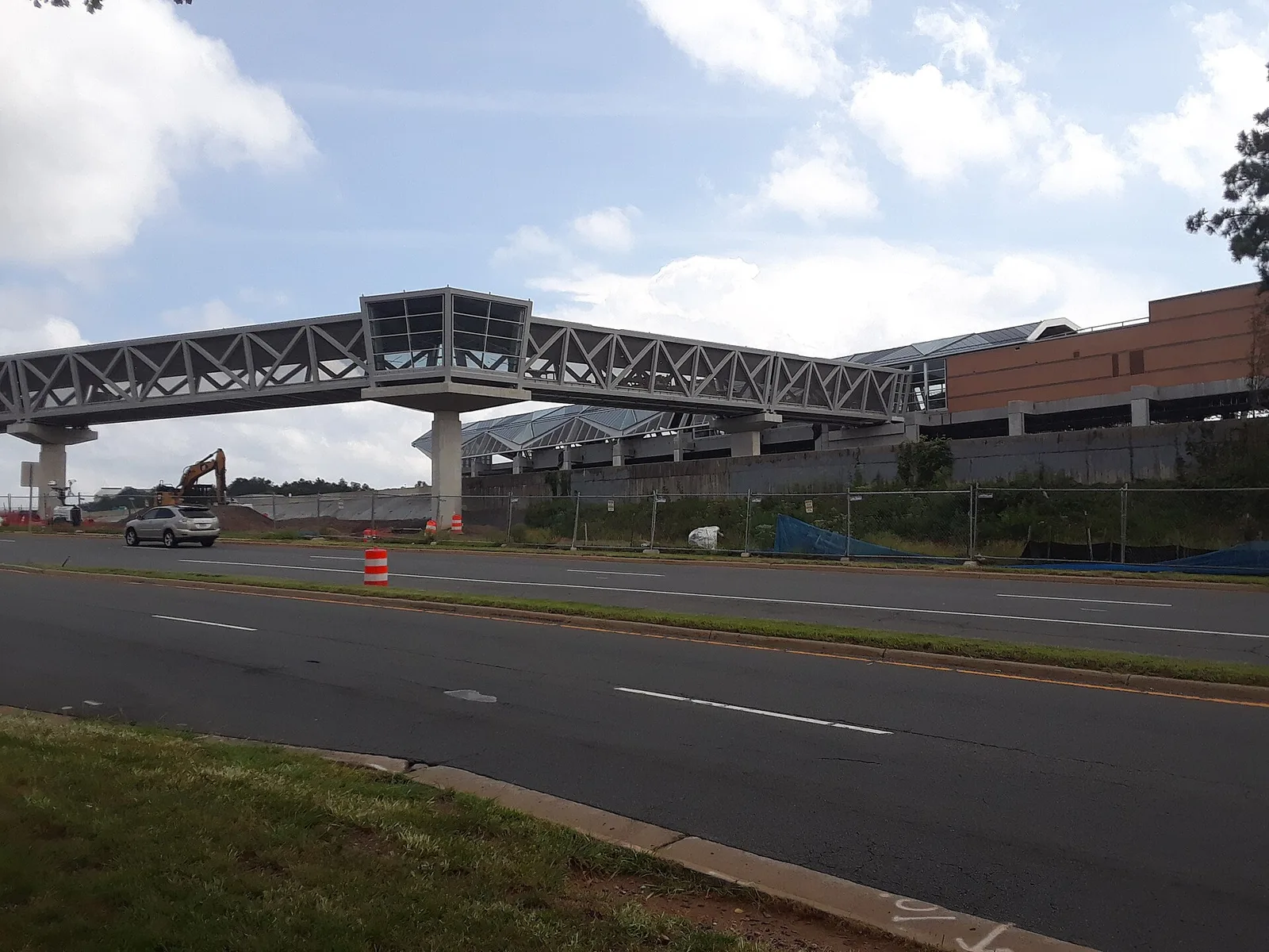
The Reston Town Center station area, the county plan's 'downtown,' covers about 893 acres in ZIPs 20190 and 20191 and is zoned for South Lakes High.
Last checked Oct. 20, 2026. Sources: Fairfax County’s Reston plan, Reston Town Center Transit Station Area (enCode Plus) and GIS layers, FCPS 2026-27 attendance areas, the Virginia Department of Education’s School Quality Profiles, Zillow Research, Fairfax Connector schedule data and OpenStreetMap.
Fairfax County’s Reston plan calls the Reston Town Center station area the “downtown” of Reston. It takes in the Town Center itself, with its plaza, shops, offices, hotels and high-rise homes; the newer towers around Reston Town Center station on both sides of the Dulles Toll Road; and older office parks, townhouses and apartments around them. The land north of the toll road “is planned to develop at the highest intensities in Reston,” the plan says. This page is about living in the area; for shops, restaurants and events, see our Reston Town Center guide.
What this means for you
- Zoned high school: South Lakes High, for the whole area. Check an address on the FCPS boundary locator.
- Home value: $546,007 in ZIP 20190 in September 2026, according to the Zillow Home Value Index.
- Nearest toll road exit: Exit 12, Reston Parkway, inside the area.
Part of our Reston neighborhoods guide.
Where it is
The county’s Reston Transit Station Areas map layer puts the area at about 893 acres. The plan splits it into districts:
- Around the station, north of the toll road: bounded by the W&OD Trail, Reston Parkway, the toll road and the county property used by the YMCA. Its Town Center North sub-district is about 88 acres “strategically located between the Reston Town Center Urban Core and the Reston Town Center Metro Station.”
- Around the station, south of the toll road: bounded by the toll road, Reston Parkway and Sunrise Valley Drive, with Edmund Halley Drive running north and south. OpenStreetMap names a neighborhood here Halley Rise.
- Town Center Urban Core: the existing Town Center, between New Dominion Parkway, Old Reston Avenue, the W&OD Trail and Town Center Parkway.
- Town Center North: between Baron Cameron Avenue, Reston Parkway, New Dominion Parkway and Town Center Parkway, planned as “a new urban neighborhood.”
- Town Center West: to Fairfax County Parkway, with “townhouses and multifamily housing, the Reston Hospital Center,” a YMCA and a Target, “planned to maintain its existing character.”
- Old Reston Avenue, Reston Heights and Central Sunrise Valley: offices, hotels and high-rise homes east of Reston Parkway, and offices and the U.S. Geological Survey headquarters to the south.
About 58% of the land is in ZIP code 20190 and 32% in 20191, with a small part in 20192, in the county’s ZIP code map. Reston is unincorporated: Fairfax County provides police, fire and rescue. See who to call.
Schools
From the FCPS 2026-27 attendance area maps in Fairfax County’s GIS, laid over the county’s station area boundary. Shares are of land, not students. Every school below is Fully Accredited for 2025-26.
| Level | School | Address | Share of area | State profile |
|---|---|---|---|---|
| Elementary | Lake Anne Elementary | 11510 North Shore Drive | 58% | report card |
| Elementary | Dogwood Elementary | 12300 Glade Drive | 37% | report card |
| Elementary | Terraset Elementary | 11411 Ridge Heights Road | 5% | report card |
| Middle | Hughes Middle | 11401 Ridge Heights Road | All | report card |
| High | South Lakes High | 11400 South Lakes Drive | All | report card |
Check the exact address on the boundary locator. More in our Reston schools guide.
Home values
The typical home value in ZIP 20190 was $546,007 in September 2026, up 0.4% from $543,928 in September 2025, according to the Zillow Home Value Index. In 20191 it was $610,099, up 0.5%. For all of Reston, Zillow’s figure was $622,037. The index is a modeled typical value for the middle third of homes, not a sale price, and both ZIP codes reach far beyond the station area. More in our home prices guide.
Parks and trails
From OpenStreetMap:
- Reston Town Square Park, Presidents Park, Hyatt Park and Reston Town Green Park, urban parks inside the area.
- Canis Major Dog Park, inside the area.
- The Washington and Old Dominion Railroad Trail, which crosses the area north of the toll road.
The plan calls for “a large, signature community gathering space near the station entrance” and a “larger-scale park” south of the toll road as the area builds out. More in our parks and trails guide and walking and biking trails guide.
Getting around
- Metro: Reston Town Center station on the Silver Line, in the middle of the area.
- Toll road: Exit 12 (Reston Parkway) inside the area and Exit 11 (Fairfax County Parkway, Route 286) about 1.4 miles west, by the exit numbers in OpenStreetMap.
- Airports: about 8.1 miles to Washington Dulles International and 24 miles to Reagan National. Downtown Washington: about 22.7 miles to Metro Center. These are distances from the middle of the area on the OpenStreetMap road network with the OSRM routing engine, not drive times.
- Buses: Fairfax Connector routes 553, 559, 574, 605, 950, 951 and 952 and all five RIBS loops stop in the area, according to the county’s schedule data. See Connector schedules.
More in our getting around guide.
Homeowners associations
The county plan says Reston Association governs most of Reston outside the station areas, and names the Reston Town Center Association alongside it for new development in the Reston plan introduction. Many homes here are condominiums or apartments with their own associations or landlords; ask which applies to an address.
Groceries and everyday stores
From OpenStreetMap:
- Wegmans, 11950 Hopper St.
- Whole Foods Market, 1861 Fountain Drive
- Harris Teeter, Spectrum Center, off Reston Parkway
- CVS Pharmacy, 12027 Town Square St.
- Trader Joe’s, 11958 Killingsworth Ave., just outside the area
The plan also lists a Target in the Town Center West district.
How we drew this area
Reston Town Center is one of three transit station areas in Fairfax County’s Comprehensive Plan for Reston. Its edges here are the county’s own, from the Reston Transit Station Areas layer in the county GIS. School and ZIP shares come from laying the FCPS attendance areas and the county ZIP code map over that boundary. Park and store locations are © OpenStreetMap contributors.
Frequently asked questions
What is the Reston Town Center area?
Fairfax County’s Reston plan calls the Reston Town Center Transit Station Area the ‘downtown’ of Reston. It covers about 893 acres around Reston Town Center station on both sides of the Dulles Toll Road, from Baron Cameron Avenue south to South Lakes Drive.
What schools serve the Reston Town Center area?
All of it is zoned for Hughes Middle and South Lakes High in FCPS’s 2026-27 maps. The elementary zones are Lake Anne for most of the land north of the toll road and Dogwood for most of it south, with a small part in Terraset. All are Fully Accredited for 2025-26.
Is Reston Town Center a good place to live?
Here are the facts. The area has high-rise and mid-rise apartments and condos, townhouses, offices, the Reston Town Center shops and a Metro station, plus three supermarkets. Its zoned schools are all Fully Accredited for 2025-26, and Zillow put the typical home value in ZIP 20190 at $546,007 in September 2026.
What grocery stores are near Reston Town Center?
OpenStreetMap lists Wegmans on Hopper Street, Whole Foods Market on Fountain Drive and Harris Teeter at Spectrum Center inside the station area, with a Trader Joe’s on Killingsworth Avenue just outside it.
Have your say